Best Apps for Crop Monitoring in 2026: 8 Apps Compared
By ToolNimba Editorial Team October 29, 2026 8 min read

- Top pick
 OneSoil
Free satellite field monitoring
Starting priceFreeCheck out OneSoilRead our review - Runner-up
 EOSDA Crop Monitoring
Satellite analytics and weather data
Starting priceSee websiteCheck out EOSDA Crop MonitoringRead our review - Also great
 Climate FieldView
Farms already collecting machine data
Starting priceFreeCheck out Climate FieldViewRead our review
How we researched this
We compared official pricing and feature pages, app store listings, privacy policies and public user reviews. Prices change, so check the provider's site before you pay.
Key takeaways
- OneSoil and EOSDA Crop Monitoring give small farms satellite monitoring at little or no cost, which makes them easy first steps.
- Drone based tools like Agremo and Sentera add detail that satellites cannot match, but they need a drone and more time in the field.
- Climate FieldView suits farms that already collect machine data and want it tied to imagery and yield maps.
- Taranis and FarmQA serve agronomists and advisers who scout many fields and need reports they can share with growers.
- Satellite images update every few days, so pair any app with regular field walks for problems that need a closer look.
Quick comparison
| Name | Best for | Starting price | Free plan | |
|---|---|---|---|---|
| OneSoil | Free satellite field monitoring | Free | Yes | Visit |
| EOSDA Crop Monitoring | Satellite analytics and weather data | See website | Free trial | Visit |
| Climate FieldView | Farms already collecting machine data | Free | Yes | Visit |
 Taranis | AI scouting for advisers and retailers | See website | No | Visit |
 Agremo | Drone image analysis and prescription maps | See website | Free trial | Visit |
 Sentera | Drone analytics for agronomy teams | See website | Free trial | Visit |
 FarmQA | Digital scouting reports | See website | Free trial | Visit |
 CropX | Soil and irrigation decisions | See website | Free trial | Visit |
The best apps for crop monitoring
Crop monitoring apps turn satellite images, drone flights and field notes into maps that show where a crop is stressed, dry or behind schedule. We compared official feature pages, pricing pages and public documentation to build this list, focusing on tools that work for US farms in 2026.

OneSoil is the easiest free way to start monitoring crops from space. Add your fields and the app pulls satellite imagery to show vegetation indexes, growth stages and problem areas, with automatic field boundary detection. The mobile app supports scouting on foot, so you can check a flagged spot and record notes and photos.
The free tier covers the core monitoring most small farms need. Variable rate application maps and deeper analytics sit in the paid Pro plan. Satellite images refresh every few days rather than daily, and 10 meter resolution will not show single plants, but for field level decisions the free version is hard to beat.
- Free satellite monitoring for unlimited fields
- Automatic field boundaries
- NDVI and productivity zone maps
- Paid Pro features needed for variable rate maps
- Satellite resolution limits fine detail
EOSDA Crop Monitoring
Best for: Satellite analytics and weather data
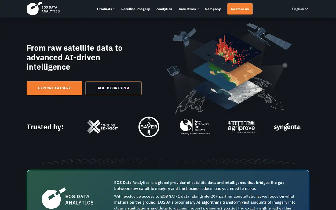
EOSDA Crop Monitoring is a satellite platform aimed at farmers, agronomists and agribusinesses. It tracks crop health with a wide set of vegetation indexes, adds soil moisture estimates and field level weather, and sends risk notifications when conditions shift. Historical imagery helps compare this season with past ones.
The platform is deeper than a simple NDVI viewer, which suits advisers and larger operations. Pricing depends on monitored area and selected features, so expect a quote for larger acreage. A trial lets you test it on your own fields before committing.
- Many vegetation indexes and historical data
- Soil moisture and weather analysis
- API access
- Pricing varies by area and features
- Most value comes with a paid plan

FieldView, from Bayer, starts free with field level satellite imagery, scouting tools and basic data organization. Connect compatible planters, combines and sprayers and it layers machine data over imagery, so you can compare planting, application and yield maps side by side.
The free tier is genuinely useful for record keeping and scouting. Paid tiers add higher resolution imagery, more frequent updates and advanced analysis. Farms without connected equipment get less from FieldView than farms that already log machine data.
- Free basic tier
- Ties imagery to planting and yield data
- Wide equipment compatibility
- Advanced imagery and scripting features are paid
- Value grows with connected machines
Taranis flies high resolution cameras over fields repeatedly through the season and uses AI to spot weeds, insects, disease and emergence problems at leaf level. Agronomists and ag retailers use it to cover many acres quickly and to give growers photo evidence of what needs attention.
The detail goes well beyond satellite tools, which is the point. Pricing is quote based and the service model suits advisers managing many client fields. Individual growers usually access Taranis through their retailer or adviser rather than buying direct.
- Leaf level aerial imagery
- AI detection of weeds, insects and disease
- Stand counts
- Quote based pricing
- Aimed at advisers more than individual growers
Agremo analyzes drone and satellite imagery to count plants, map weeds, measure stands and build prescription maps for variable rate application. It connects with common drone platforms and farm software, including John Deere Operations Center, so outputs can move straight to machinery.
The analysis quality depends on good drone flights, so farms need a drone or a service provider. A free trial covers a first analysis. For growers who already fly drones, Agremo turns raw images into decisions without manual counting.
- Plant counting and weed detection from drone images
- Prescription map export
- Satellite monitoring included
- Needs drone flights for full value
- Analysis pricing depends on area
Sentera pairs drone hardware and sensors with analytics software for stand counts, weed mapping, crop health and field trials. Agronomy teams use it to run repeatable surveys across plots and fields, and the platform supports research style comparisons between treatments.
Sentera sells sensors and software together, so budget for both if you do not already own a compatible drone. The analytics are among the strongest in this list for agronomy work, but casual users may find simpler apps faster to learn.
- Strong analytics for stand, weed and health mapping
- Works with DJI drones
- Field trial tools
- Drone and sensor costs are separate
- Learning curve for new drone users
FarmQA is built for agronomists and crop consultants who scout fields for clients. Custom templates, geo-tagged photos, map annotations and offline mode support field work without a signal, and finished reports export as PDFs that growers can read and act on.
Pricing is per user and role rather than per acre, which suits advisers with large territories. Satellite imagery comes through integrations such as Planet, so check which imagery options your plan includes. For a scouting business, the reporting workflow is the main draw.
- Custom scouting templates
- Offline field work
- Clean PDF reports for growers
- Charged per user rather than per acre
- Imagery features depend on integrations
CropX combines soil sensors with satellite imagery and weather data to guide irrigation and fertilizer decisions. Its sensors measure soil moisture and temperature at depth, and the app turns readings into irrigation recommendations and water use reports.
The hardware cost sets CropX apart from pure imagery apps, but irrigated farms often recover it through water and energy savings. A trial is available. If your main question is when and how much to water, CropX answers it more directly than imagery alone.
- Soil sensor data plus satellite imagery
- Irrigation recommendations
- Water use tracking
- Sensors add hardware cost
- Best for irrigated crops
How we picked these
We compared official feature pages, pricing pages and public documentation for each app, and favored tools that are actively sold and supported in October 2026. We mixed free satellite apps, drone analytics and scouting platforms so the list covers small farms, advisers and larger operations. Prices come from vendor pages or, where pricing is quote based, we say so plainly rather than guessing.
How to choose a crop monitoring app
Start with how you want to collect data. Satellite apps need no hardware and suit field level checks, while drone apps give finer detail at the cost of flights and equipment. Next, check what happens after the map: scouting tools, prescription exports and irrigation advice turn images into actions.
Match the app to your acreage
Small farms often do fine with a free satellite app plus field walks. Larger operations and advisers benefit from paid analytics, automated alerts and reporting tools that save hours each week.
Check imagery refresh and resolution
Satellite tools typically refresh every few days at 10 meter resolution, while drone flights give centimeter detail on demand. Match refresh speed to the problems you face: fast moving pests and irrigation stress reward quicker updates.
Start with one field, not the whole farm. Map a single field, set up alerts for that crop, and learn how the app's health scores line up with what you see on the ground. After a few weeks you will know which alerts deserve a visit and which can wait. Then roll the same setup out field by field, keeping the alert thresholds you trust and dropping the noisy ones. This slow rollout avoids alert fatigue, which is the main reason farm apps get abandoned.