Best Map App in 2026: 9 Apps Compared
By ToolNimba Editorial Team October 29, 2026 11 min read

- Top pick
 Google Maps
All-round maps, transit and places
Starting priceFreeCheck out Google MapsRead our review - Runner-up
 Waze
Live traffic and driver reports
Starting priceFreeCheck out WazeRead our review - Also great
 Apple Maps
Built-in navigation for Apple devices
Starting priceFreeCheck out Apple MapsRead our review
How we researched this
We compared official pricing and feature pages, app store listings, privacy policies and public user reviews. Prices change, so check the provider's site before you pay.
Key takeaways
- Google Maps is the best all-round map app for most people, with driving, transit, walking and business details in one place.
- Waze is the best choice for drivers who want live traffic and hazard reports from other drivers.
- Apple Maps suits iPhone users who want clean directions built into their phone, watch and car display.
- OsmAnd, MAPS.ME and HERE WeGo are the strongest offline options for travel, hiking and areas with poor signal.
- Sygic and TomTom GO add paid offline driving features for drivers who want a dedicated navigation app without ads.
Quick comparison
| Name | Best for | Starting price | Free plan | |
|---|---|---|---|---|
| Google Maps | All-round maps, transit and places | Free | Yes | Visit |
| Waze | Live traffic and driver reports | Free | Yes | Visit |
| Apple Maps | Built-in navigation for Apple devices | Free | Yes | Visit |
 MapQuest | Simple directions and route planning | Free | Yes | Visit |
 HERE WeGo | Offline maps and public transport | Free | Yes | Visit |
 Sygic | Offline 3D driving navigation | Free | Yes | Visit |
 TomTom GO | Dedicated paid driving navigation | See website | Free trial | Visit |
 OsmAnd | Detailed offline maps and trails | Free | Yes | Visit |
 MAPS.ME | Quick offline city maps for travel | Free | Yes | Visit |
The best map apps
A map app earns its place by getting you to the right place without fuss. Some drivers care most about live traffic, travelers care most about offline maps, and city dwellers care most about transit times. The nine apps below cover those jobs, and most of them are free, so you can keep a main app plus an offline backup.
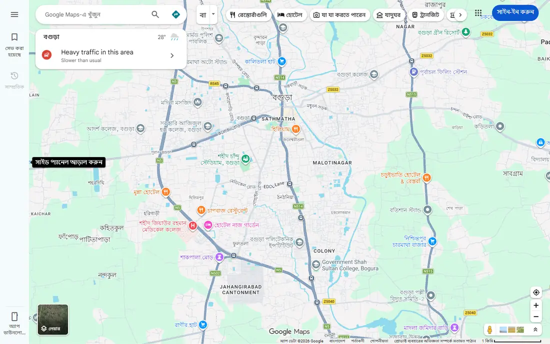
Google Maps remains the default map app for most people because it does the most jobs well. It covers driving with live traffic, public transit with departure times, walking and cycling routes, and detailed information on businesses, including hours, reviews and photos. It also works on Android, iOS and the web, so your saved places follow you across devices.
The main limits are offline use and privacy. Downloaded offline areas expire after about 30 days, so a traveler needs to refresh them before a trip, and Google Maps collects location data as part of Google services unless you change your settings. For everyday navigation and trip planning, though, no other single app matches its breadth.
- Driving, transit, walking and cycling directions in one app
- Detailed business hours, reviews and photos
- Downloadable offline areas
- Offline maps expire after about 30 days
- Heavy data and battery use on long trips
Waze is owned by Google, but it feels like a different app because its strength is the driver community. Other drivers report crashes, road closures, speed traps and hazards in real time, and Waze reroutes quickly around trouble. For a daily commute or a long highway drive, those live reports often save more time than a static route.
Waze is weaker outside the car. It does not offer offline maps, and its transit, walking and place information are thinner than Google Maps. It also shows ads, which some drivers find distracting. Keep Waze for driving, and keep Google Maps or HERE WeGo for everything else.
- Live hazard, police and traffic reports from other drivers
- Fast rerouting around jams
- Simple and clear driving view
- No offline maps for driving
- Fewer transit and walking features than Google Maps
- Ads in the free app
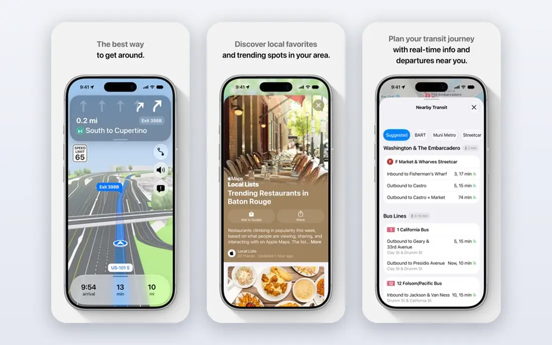
Apple Maps is the obvious pick if you already use an iPhone. It is built into the phone, the Watch and CarPlay, so directions start without installing anything, and handoff between devices feels natural. Turn-by-turn directions are clear, lane guidance helps at complex junctions, and Apple processes much of the routing work on device, which appeals to privacy-minded users.
Apple Maps does not run on Android, so it cannot be the shared app for a mixed-device household. Its business listings and transit data are also thinner than Google Maps in some towns and countries. For iPhone owners who mostly drive or walk in well-covered areas, it is a clean and reliable default.
- Built into iPhone, Mac, Watch and CarPlay
- Clean turn-by-turn directions and lane guidance
- Strong privacy approach with on-device processing
- IPhone and Mac only
- Business details and transit coverage can lag Google Maps in some areas
MapQuest has been giving directions since the early web, and it still does the basic job well. It is a straightforward choice for driving directions and multi-stop route planning, and its web version is handy for planning a trip on a computer before driving. The interface is simple, which some users prefer to a crowded map app.
MapQuest falls behind on live traffic, transit and place details, so it is not the best app for a daily commute or a city trip on foot and transit. It works best as a simple planner for road trips and multi-stop drives, paired with Waze or Google Maps for live driving conditions.
- Simple driving directions and route planning on web and mobile
- Multi-stop route tools
- Free to use without an account for basic directions
- Fewer live traffic and transit features than Google Maps
- App feels basic next to newer navigation apps
HERE WeGo is the strongest free all-round travel app for trips abroad. You can download maps for whole countries before you leave, then navigate offline for driving, walking, cycling and public transport without roaming charges or a local SIM. That offline strength makes it a smart backup even if Google Maps is your main app.
Live traffic and place details are not as deep as Google Maps or Waze in every region, and the interface feels more functional than polished. For travelers, though, the combination of free offline maps and transit directions in one app is hard to beat, and it works on both Android and iOS.
- Free downloadable offline maps for whole regions
- Driving, transit, walking and cycling directions
- Works well for travel abroad
- Live traffic is thinner than Waze in some areas
- Interface is less polished than Google Maps
Sygic is a dedicated driving app with a long record in offline navigation. Its 3D maps, lane guidance and speed limit warnings help on unfamiliar roads, and downloaded maps work without a data connection, which matters for rural drives and travel abroad. A head-up display mode projects key directions onto the windscreen area at night.
The free version gives a useful taste of the app, but the fuller feature set, including longer offline use and premium traffic services, sits behind a paid plan. Drivers who want a dedicated navigation app without the distractions of a general map app will find Sygic worth testing, especially for road trips.
- Offline 3D maps for driving in many countries
- Lane guidance and speed limit alerts
- Head-up display option for night driving
- Full premium features need a paid subscription
- Free version is limited for long-term use
TomTom GO is the app version of the dedicated sat nav many drivers already know. It uses TomTom maps and traffic data, offers offline maps, and keeps the driving view clean and focused on the road ahead. Speed camera alerts and lane guidance are available where local rules allow them.
TomTom GO is a paid app after its trial, so it only makes sense if you drive a lot and value its traffic data and offline maps over free options. It is not a general map app for transit or walking, so most users will still keep Google Maps or HERE WeGo alongside it. For frequent drivers, the focused driving experience is the selling point.
- TomTom traffic and map data with a clear driving view
- Offline maps
- Lane guidance and speed camera alerts where available
- Paid subscription after the trial
- No transit or walking depth to match Google Maps
OsmAnd is the favorite of hikers, cyclists and travelers who need detail that mainstream apps skip. Built on OpenStreetMap data, it offers offline maps, contour lines, hiking and cycling routes, and points of interest for trails and rural areas. It works without a data connection once maps are downloaded, and it does not require an account for basic use.
OsmAnd asks more of the user at first. The menus are deep, map downloads take time and storage, and the interface is less polished than Google Maps. Users who walk trails, cycle rural routes or travel off the main roads will find that effort worthwhile, while city drivers will likely prefer Waze or Google Maps.
- Detailed offline maps from OpenStreetMap data
- Hiking, cycling and contour maps
- Privacy-friendly with no account needed for basic use
- Interface takes learning
- Map downloads and setup need more effort than Google Maps
MAPS.ME is the simplest offline travel app on this list. Download a city or region map, search for hotels, restaurants and sights, and navigate without a data connection. That simplicity makes it a good travel companion, especially for short city trips where you do not want to manage a complex app.
MAPS.ME is not a live traffic app, and its transit features are thinner than Google Maps or HERE WeGo. Its rural and trail detail also lags OsmAnd. For a quick offline backup in a city, though, MAPS.ME is easy to set up and easy to use, which is exactly what a traveler needs after landing.
- Fast offline maps for cities and travel
- Simple search and bookmarking
- Works on Android and iOS without a data connection
- Fewer live traffic and transit features
- Map data can be less detailed for rural trails than OsmAnd
How we picked these
We compared official app pages, app store listings and public documentation for each app, along with public reviews of real driving, transit and offline use. We kept only apps that are live in October 2026, that cover general mapping or navigation, and that work in the US as well as abroad where stated. We weighed live traffic, offline maps, transit coverage, platform support and price, and we noted where a paid plan is needed for the full feature set. No vendor paid for a place on this list.
How to pick the right map app for your trips
Start with how you travel most. Drivers need live traffic, transit users need departure times, and travelers need offline maps. One app rarely wins on all three, so most people end up with a main app and a backup.
Keep a main app and an offline backup
Use Google Maps or Apple Maps as your daily app, and keep HERE WeGo, OsmAnd or MAPS.ME with downloaded maps as a backup. Download the maps for every region on your route, including places you only pass through, and test them in airplane mode before you leave. A backup that has never been tested is not a backup.
Check traffic, transit and place details for your area
Live traffic quality varies by city, and transit data varies by transit agency. Test two apps on your real commute or trip before you rely on one, and compare arrival times, reroutes and transit options. The app with the best data in your city matters more than the app with the longest feature list.
Watch battery, data and storage
Navigation apps use a lot of battery and, without offline maps, a lot of data. Carry a car charger on long drives, download maps on Wi-Fi, and delete old offline areas to free storage. If you drive daily, a phone mount and a charger matter as much as the app you choose.