Best Hunting Apps in 2026: 9 Apps Compared
By ToolNimba Editorial Team November 9, 2026 12 min read

- Top pick
 onX Hunt
Land ownership and multi-state hunting
Starting price$34.99 per yearCheck out onX HuntRead our review - Runner-up
 HuntStand
Free mapping and land management
Starting priceFreeCheck out HuntStandRead our review - Also great
 HuntWise
Forecasts and scouting tools
Starting priceSee websiteCheck out HuntWiseRead our review
How we researched this
We compared official pricing and feature pages, app store listings, privacy policies and public user reviews. Prices change, so check the provider's site before you pay.
Key takeaways
- onX Hunt is the standard for land ownership and boundary data, especially for hunters who cross state lines or hunt public land.
- HuntStand offers the best free starting point, with a usable free tier and paid plans for property lines and forecasts.
- HuntWise, BaseMap, and Spartan Forge add scouting forecasts and weather tools, but they do not replace checking state regulations.
- App boundary lines are a guide, not a legal survey, so confirm access with the landowner and your state wildlife agency before you hunt.
Quick comparison
| Name | Best for | Starting price | Free plan | |
|---|---|---|---|---|
| onX Hunt | Land ownership and multi-state hunting | $34.99 per year | No | Visit |
| HuntStand | Free mapping and land management | Free | Yes | Visit |
| HuntWise | Forecasts and scouting tools | See website | Yes | Visit |
 BaseMap | Budget mapping with terrain layers | $39.99 per year | Yes | Visit |
 GoHunt | Western draw odds research | See website | No | Visit |
 Spartan Forge | Deer movement prediction | $79.99 per year | No | Visit |
 CoHunt | Group tracking and offline maps | $24.99 per year | No | Visit |
 Infinite Outdoors | Booking private land hunts | Free | Yes | Visit |
 LandTrust | Private land access marketplace | Free | Yes | Visit |
The best hunting apps
We compared official pricing pages, app store listings, and recent hunting app summaries for apps that help with mapping, scouting, and land access today. The best hunting app for you depends on where you hunt, whether you need landowner data, and whether you hunt alone or with a group. Use the list below to pick a mapping app first, then add a scouting or booking app only if it solves a problem your map app does not.
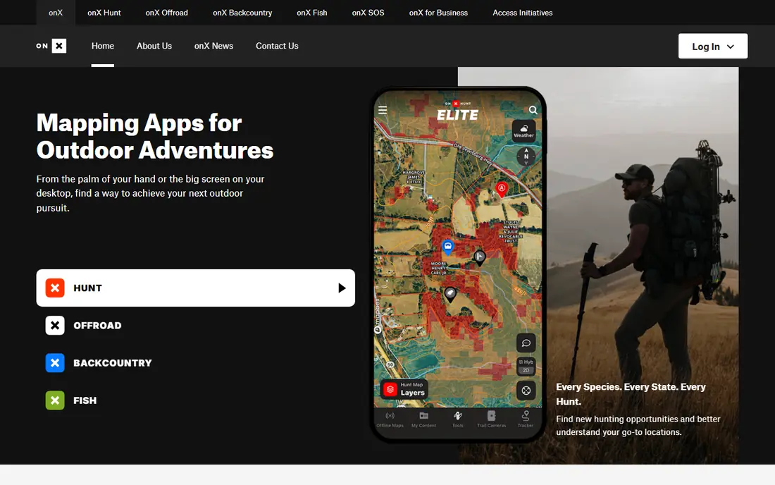
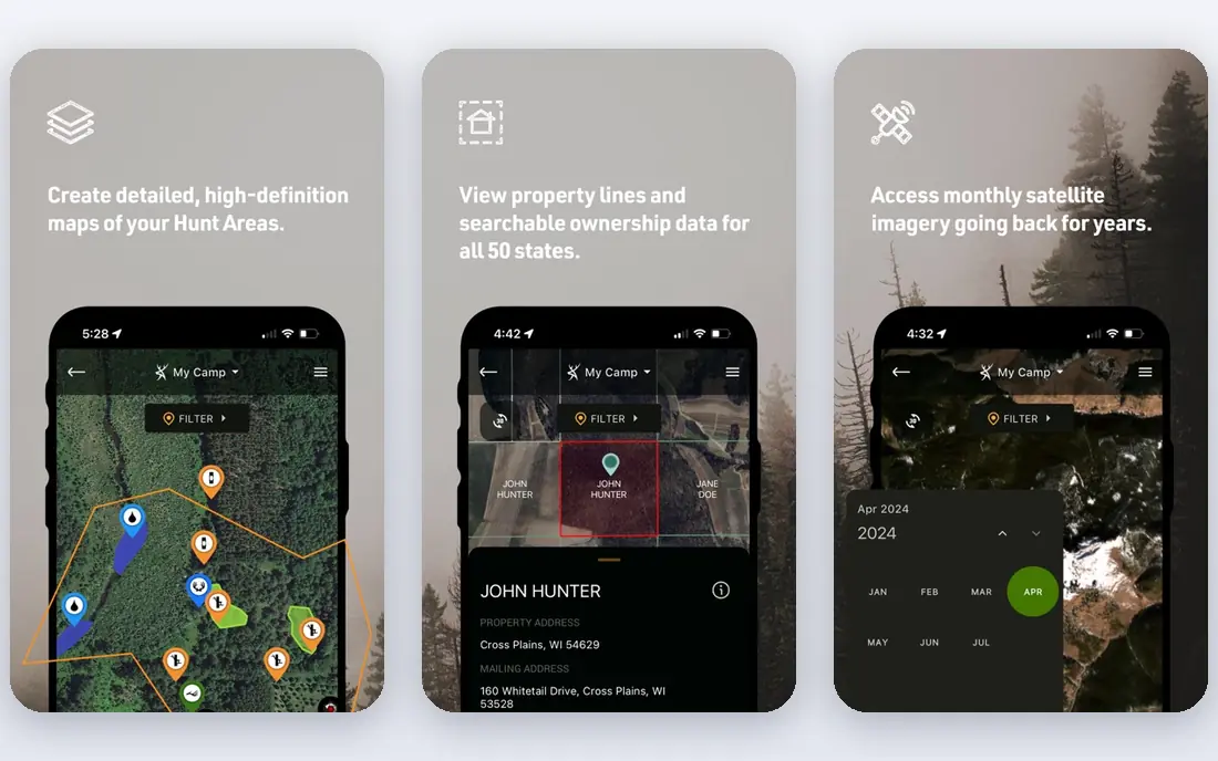
onX Hunt is the most widely used hunting map app for a reason: its land ownership layers, parcel boundaries, and landowner names help hunters understand who owns the ground before they step onto it. It also offers satellite imagery, topographic maps, offline downloads, and waypoint sharing, which matter when cell signal fails in the backcountry. For multi-state hunters and public land hunters, the Elite plan covering all 50 states is the main draw.
The cost is the catch. A single-state plan starts lower, but Elite costs about $99.99 per year, and there is no free tier that covers the full mapping experience. Boundary data is also a guide, not a legal survey, so you should still confirm access and local rules. If you hunt in several states or rely on public land, onX Hunt is our pick for most people.
- Detailed private and public land boundaries
- Offline maps and 3D terrain
- Trail camera and waypoint sharing
- No true free tier
- Elite plan costs more for all 50 states
HuntStand is the best place to start if you want to try a hunting map app without paying first. The free tier covers basic mapping and waypoint marking, which is enough to learn whether the interface suits how you scout. Paid Pro and Ultimate plans add property boundaries, 3D maps, weather layers, and activity forecasts for multiple species, plus trail camera integration.
HuntStand suits private land hunters and land managers who track stands, feeders, cameras, and property lines in one place. Its group features also help hunting parties share pins and messages. If you hunt mostly one property and want a low-cost start, HuntStand is a strong first download, and you can upgrade only if the paid layers earn their price.
- Usable free tier
- Property lines and 3D maps on paid plans
- Trail camera and stand management
- Offline maps and some layers need paid plans
- Forecast tools are on higher tiers
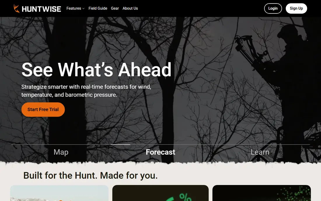
HuntWise combines mapping with prediction tools that many deer hunters value, including wind, weather, and activity forecasts. You can mark stands and cameras, share hunt areas with a group, and check conditions before a sit. That blend of map and forecast makes it a good all-in-one scouting app for whitetail hunters who want more than just boundaries.
The free tier is useful, but the most detailed forecasts and layers sit behind paid plans, so check the current plan page for the tier that includes the features you want. HuntWise is not as deep on landowner data as onX Hunt in some areas, so multi-state public land hunters may still prefer onX. For forecast-led scouting, HuntWise is a strong, affordable option.
- Hunting forecasts and wind tools
- Public and private land maps
- Shared hunt areas
- Some premium features need higher tiers
- Pricing varies by plan and promotion
BaseMap offers hunting maps, landowner data, offline downloads, and terrain layers at a lower entry price than the top tier of onX Hunt. It suits budget-minded hunters who want property boundaries and 3D terrain without paying for the most expensive plan. The app covers US hunting areas and includes tools for marking waypoints, tracking, and sharing locations.
Its community and third-party integrations are smaller than those of the market leaders, and some advanced features feel less polished. That matters less if you mainly need a reliable map and offline access. For hunters who want solid mapping at a moderate price, BaseMap is a credible alternative to the bigger names.
- Lower entry price than onX Elite
- Offline maps and terrain layers
- Landowner data on paid plans
- Smaller community than onX or HuntStand
- Some features are still developing
GoHunt is built for western big-game hunters who apply for draws across several states. Its research tools cover draw odds, unit histories, harvest data, and season details, which help you choose where to apply and how to plan a hunt years ahead. It also includes mapping tools, so research and scouting live in one place.
The price is higher than a basic map app, and the value depends on whether you actually hunt western draws. Eastern hunters who only hunt local private land will get less from GoHunt than from HuntStand or onX. For western hunters, though, the draw research alone can justify the cost, because a better unit choice affects the whole season.
- Deep draw odds and unit research
- Western big-game focus
- Mapping and filtering tools
- Higher cost than a simple map app
- Less useful for eastern whitetail-only hunters
Spartan Forge focuses on predicting deer movement using terrain, weather, and historical patterns, rather than just showing a map. Hunters use its forecasts to choose stand locations and timing, and its mapping tools help plan access routes and wind-aware setups. That prediction focus sets it apart from map-only apps.
Forecasts should be treated as guidance, not as a promise that deer will appear at a given time. Weather, pressure, and local conditions change quickly, and no app replaces time in the field. Spartan Forge suits deer hunters who already have a map app or who want prediction as their main scouting tool, and who are willing to pay more for that specific feature.
- AI-based deer movement forecasts
- Mapping and planning tools
- Focus on patterning deer behavior
- Higher price than basic map apps
- Forecasts are predictions, not guarantees
CoHunt offers a single-tier price that undercuts many rivals, with property boundaries, offline maps, group tracking, and messaging in one plan. That simplicity appeals to hunting groups that want everyone on the same map without juggling tiers. Group members can share locations, pins, and messages, which helps with safety and coordination in large areas.
Its user base is smaller than onX or HuntStand, so fewer hunting partners may already use it, and third-party integrations are more limited. For a group that adopts one app together, CoHunt offers strong value. For a solo hunter who wants the widest community and integration support, a larger app may be a better fit.
- Low single-tier price
- Group tracking and messaging
- Offline maps and boundary data
- Smaller user base than onX
- Fewer third-party integrations
Infinite Outdoors is different from a map app: it helps you book hunts on vetted private land. You can browse properties, check mapping layers, and book directly through the platform, with an optional membership that adds benefits. That suits hunters who lack private land access and want a legal, arranged hunt without paying full outfitter prices.
Availability depends on your state and the properties listed, so it is not a universal replacement for scouting your own ground. Booking fees and property rules also vary, so read each listing carefully. For hunters seeking new private land access, Infinite Outdoors is a useful complement to a mapping app.
- Vetted private properties to book
- Free browsing and mapping layers
- Direct booking through the platform
- Availability varies by state and property
- Booking costs are extra
LandTrust operates a marketplace where landowners list private land for hunting, fishing, and other outdoor activities. You can browse free, compare properties across many states, and book access for a set period or activity. That breadth makes it useful for hunters planning a trip to a new state.
Because LandTrust is a marketplace, quality, price, and rules vary by landowner, so read reviews, property details, and access terms before booking. It also lacks a full mobile app experience for some tasks, so plan bookings on a computer where possible. For private land access at scale, LandTrust is one of the largest options available.
- Large marketplace of private land
- Browse free before booking
- Activities beyond hunting
- No mobile app for some workflows
- Booking costs vary widely by property
How we picked these
We compared official pricing pages, app store listings, and recent hunting app summaries for apps that help with mapping, scouting, forecasts, or land access today. We favored apps with clear pricing or a free tier, offline map support where relevant, and a realistic fit for US hunters. We did not claim hands-on testing, and where a price could not be confirmed from a vendor page in our research, we wrote See website. Always check your state wildlife agency for season dates, license rules, and land access laws before hunting.
Safety and land access: what every hunter should check
An app map is a starting point, not permission. Parcel lines can be outdated, land can change hands, and public land can have seasonal closures or special rules. Before you hunt, confirm the land status with the landowner, a state wildlife agency map, or a local office, and carry a paper map or offline download as backup. Tell someone where you plan to hunt and when you expect to return, especially on public land with poor signal.
Safety also means knowing your target and what lies beyond it, wearing required hunter orange where your state requires it, and following firearm safety rules regardless of what any app shows. Apps help with navigation and scouting, but they do not replace hunter education, local knowledge, or common sense in the field. If an app boundary and a posted sign disagree, trust the sign and the landowner, and sort it out before you hunt that spot.
Offline maps and battery
Download offline maps for your exact hunt area before you leave home, and test them with your phone in airplane mode. Carry a portable battery pack, because GPS and screen use drain phones quickly in cold weather. Mark your vehicle, camp, and stand locations as waypoints, and share your plan with a hunting partner. A phone is a tool, not a substitute for a compass and a basic map if the battery dies.
Choosing between a map app and a forecast app
A map app answers where you can hunt and how to get there. A forecast app answers when deer may move and which stand suits the wind. Most hunters need the map first, because land access and navigation affect safety. Add a forecast app only if you already scout regularly and want help choosing between stands you know. Paying for two apps that duplicate maps is rarely worth it, so pick one primary map and one forecast tool at most.
Sources
Frequently asked questions
What is the best hunting app for maps?
For most hunters, onX Hunt is the best hunting app for maps, because of its land ownership layers, offline maps, and multi-state coverage. HuntStand is the best free starting point, and BaseMap is a solid budget alternative. The best app for hunting in your area also depends on how accurate its parcel data is locally, so test a free tier or trial on ground you know before paying.
What is the best hunting map app for private land?
HuntStand and onX Hunt both suit private land hunters, with property lines, landowner names, and tools for marking stands and cameras. HuntStand offers a free tier and strong land management features, while onX offers deeper landowner data across states. If you hunt one private property, start with HuntStand free. If you hunt many properties or public land as well, onX is the stronger all-round map.
What is the best free hunting app?
HuntStand offers the most usable free tier among major hunting map apps, with basic mapping and waypoint tools at no cost. HuntWise and BaseMap also offer free tiers with limits. Infinite Outdoors and LandTrust let you browse private land free, though booking costs extra. Free tiers are a good test, but offline maps and full property lines usually require a paid plan.
What is the best hunting GPS app for offline use?
onX Hunt, HuntStand, BaseMap, and CoHunt all offer offline maps on paid plans, which is essential where cell signal is weak. Download maps for your hunt area before you leave, and test them offline. A dedicated handheld GPS can be a backup, but most hunters now rely on a phone app with downloaded maps plus a portable battery pack.
Do hunting apps show landowner names accurately?
Hunting apps show landowner data from public parcel records, which can be outdated if land recently changed hands. Treat the names and lines as a guide for research, not as proof of ownership or permission. Confirm ownership and permission directly with the landowner or county records before hunting private land, and respect posted signs even if an app shows a different boundary.
Which hunting app is best for western big-game draws?
GoHunt is the best hunting app for western draw research, because it focuses on draw odds, unit histories, and season planning across western states. onX Hunt pairs well with it for mapping once you draw a tag. If you do not apply for western draws, GoHunt offers less value than a general map app such as onX or HuntStand.