Best Map Apps for Road Trips in 2026: 9 Apps Compared
By ToolNimba Editorial Team November 13, 2026 10 min read

- Top pick
 Google Maps
All-round navigation and place search
Starting priceFreeCheck out Google MapsRead our review - Runner-up
 Apple Maps
Navigation built into Apple devices
Starting priceFreeCheck out Apple MapsRead our review - Also great
 Waze
Live traffic and driver reports
Starting priceFreeCheck out WazeRead our review
How we researched this
We compared official pricing and feature pages, app store listings, privacy policies and public user reviews. Prices change, so check the provider's site before you pay.
Key takeaways
- Google Maps is the best all-round road trip app, with place search, routing, and downloadable maps in one free app.
- Roadtrippers is the best trip planner for multi-stop US and Canada routes, with attractions and collaboration built in.
- Waze is the best companion for live traffic, but it needs a data connection and should not be your only offline tool.
- HERE WeGo, Sygic, and Organic Maps are the strongest offline options for areas with poor signal.
- The best road trip setup is two apps: one for planning and live traffic, and one with maps downloaded for the whole route.
Quick comparison
| Name | Best for | Starting price | Free plan | |
|---|---|---|---|---|
| Google Maps | All-round navigation and place search | Free | Yes | Visit |
| Apple Maps | Navigation built into Apple devices | Free | Yes | Visit |
| Waze | Live traffic and driver reports | Free | Yes | Visit |
 Roadtrippers | Multi-stop trip planning | Free | Yes | Visit |
 HERE WeGo | Offline maps and public transport | Free | Yes | Visit |
 Sygic | Premium offline driving navigation | Free | Yes | Visit |
 TomTom GO | Reliable driving navigation with traffic | See website | Free trial | Visit |
 Gaia GPS | Backcountry and off-road routes | See website | Free trial | Visit |
 Organic Maps | Private offline maps from OpenStreetMap | Free | Yes | Visit |
The best map apps for road trips
A road trip app has to do more than show a route. It needs to plan stops, handle detours, work when signal drops, and help you find fuel, food, and places to stay along the way. These apps cover that range, from everyday navigation to dedicated trip planners and offline specialists.
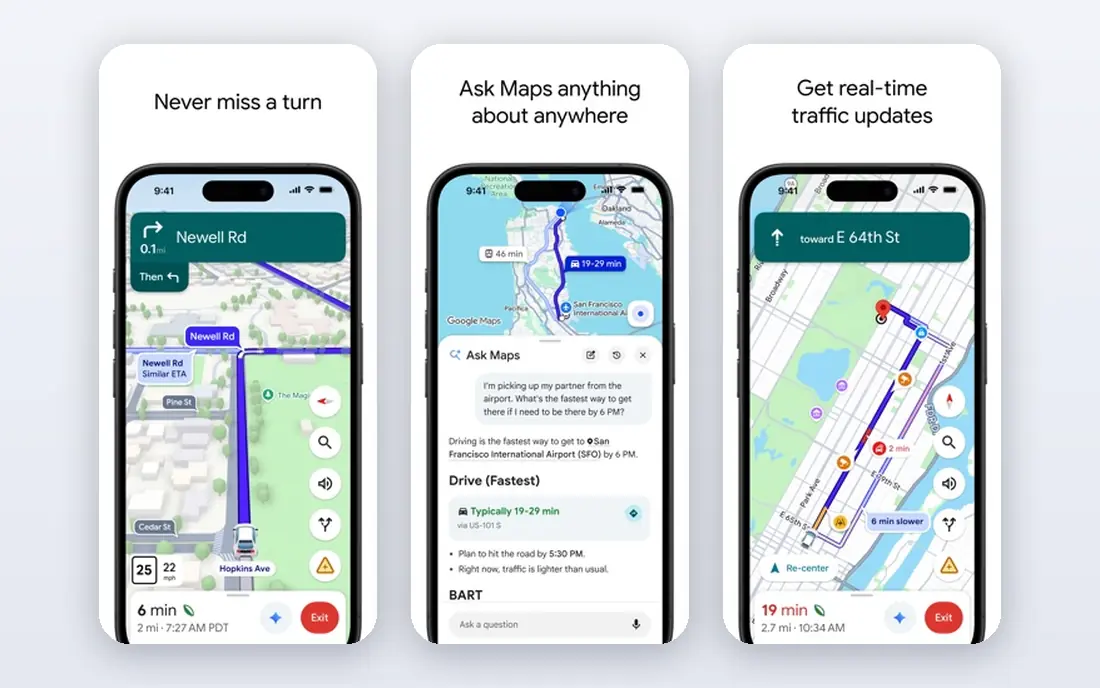
Google Maps is our pick for most road trips because it does everything well enough in one free app. Its search finds businesses, attractions, and services along a route, its live traffic adjusts ETAs, and its downloadable maps keep driving navigation working when signal drops. Shared lists also help a group collect possible stops in one place.
The limits matter on long trips. Offline maps cover driving within the downloaded area but not walking, cycling, or transit directions, and live traffic needs a connection. Download the whole route, not just the destination, and check opening hours with the business when a wasted detour would hurt.
- Best place search and business listings
- Downloadable maps for driving
- Live traffic and alternative routes
- Offline maps support driving only, not walking or transit
- Business details can be outdated
- Offline areas need updating
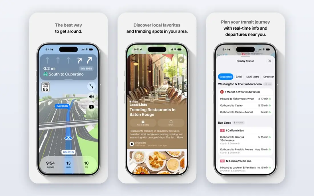
Apple Maps is the natural choice for iPhone users, since it is built into the device, works with CarPlay and Apple Watch, and handles turn-by-turn navigation cleanly. It supports offline maps in selected areas and covers driving, walking, cycling, and transit in many regions. Privacy controls are also a stated advantage over data-heavy rivals.
The trade is ecosystem. Android users get a limited experience, and place coverage is thinner than Google Maps in some areas. For a pure road trip planner with many stops, pair Apple Maps with Roadtrippers rather than relying on it alone.
- Deep integration with iPhone, CarPlay, and Apple Watch
- Clean turn-by-turn guidance
- Offline maps in selected areas
- IPhone and Apple devices only for full features
- Place data trails Google in some regions
- Fewer planning tools than Roadtrippers
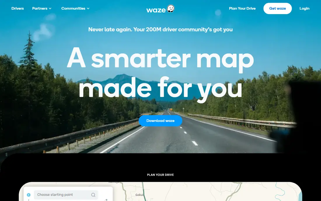
Waze is the best second app on any road trip, thanks to reports from other drivers about congestion, accidents, roadworks, and hazards ahead. Its rerouting can save real time on busy highways, and its speed display and hazard alerts are useful even without an active route. It works with CarPlay and Android Auto, so it fits most dashboards.
The catch is connectivity. Waze expects an internet connection, so it should not be your only navigation tool on routes with long coverage gaps. It also covers cars, motorcycles, and taxis only, with no walking, cycling, or truck routing. Use it for live traffic, and keep an offline app ready as backup.
- Real-time driver reports on traffic, hazards, and closures
- Smart rerouting around jams
- Free with CarPlay and Android Auto
- Needs a data connection for reliable routing
- Driving only, no walking or transit
- Can favor minor roads that quickly clog
Roadtrippers is the only app here built specifically for planning a road trip rather than just navigating one. Its Autopilot feature builds an itinerary from your interests, it surfaces attractions, parks, and quirky stops along the route, and collaborators can edit the same trip. Membership tiers are listed from $35.99 per year, with higher tiers adding offline maps, RV GPS, and more stops.
The free tier is enough to test the planner, but larger trips and offline maps need a paid membership. Coverage is also strongest in the US and Canada. For a classic multi-stop American road trip, though, no other app plans the journey as well.
- Plans multi-stop US and Canada routes with attractions
- Trip collaboration and sharing
- RV routing and offline maps on paid tiers
- Planning strength is US and Canada focused
- Offline maps and larger itineraries need membership
- Free tier limits stops per trip
HERE WeGo is a strong free all-rounder for travelers who need offline coverage. It lets you download whole countries or continents ahead of time, and it covers driving, walking, cycling, and public transport in supported areas. That makes it a good backup app for international trips and rural routes where signal is unreliable.
The compromise is search depth. Business listings and reviews are thinner than Google Maps, and live traffic features vary by region. Use HERE WeGo as your offline safety net, and keep Google Maps or Waze for live conditions and place discovery.
- Free with continent-level offline map downloads
- Driving, walking, and transit directions
- Clean interface
- Place search trails Google
- Live traffic depth varies by region
- Fewer trip-planning features than Roadtrippers
Sygic suits drivers who want a premium navigation experience that works fully offline. It offers downloadable TomTom maps, turn-by-turn guidance with lane assistance, speed camera alerts, and head-up display options on supported devices. The free version covers basic navigation, while premium tiers include the full feature set, with lifetime pricing reported in some listings.
The cost is the main consideration, since the best features sit behind payment and pricing varies by region and platform. For drivers who regularly cross areas with no signal, Sygic is a reliable primary navigator rather than just a backup.
- Full offline navigation with TomTom maps
- Speed camera alerts and lane guidance
- CarPlay and Android Auto support
- Premium features require payment
- Free version has limits
- Place search trails Google Maps
TomTom GO, the successor to TomTom's mobile navigation apps, offers dependable driving navigation with live traffic, offline maps, and speed camera alerts. Its routing draws on TomTom traffic data, which is strong on highways and in Europe as well as North America. A free trial lets drivers test it before subscribing.
The drawback is that it is a paid navigation app in a world of free ones. Google Maps and Waze cover most daily driving for free, so TomTom GO earns its subscription mainly for drivers who want its traffic data, offline reliability, and driving-focused interface without the distractions of a general map app.
- Accurate traffic and routing from TomTom data
- Offline maps
- Speed camera alerts and lane guidance
- Subscription required after the trial
- Place search is weaker than Google
- Fewer planning features than Roadtrippers
Gaia GPS is the pick when a road trip leaves the highway. It offers topographic, satellite, and public land maps, offline downloads for remote areas, and route planning for overland, off-road, and backcountry travel. That makes it the right companion for national parks, forest roads, and dispersed camping, where standard navigation apps show little detail.
The trade is focus. Gaia GPS is more than a highway trip needs, and its full features require a subscription. Pair it with Google Maps or Roadtrippers: one app for the highway, Gaia GPS for the last unpaved miles.
- Detailed topographic and satellite maps
- Offline downloads for remote areas
- Route planning for off-road and overland trips
- Subscription required for full features
- Overkill for highway-only trips
- Interface assumes comfort with map layers
Organic Maps is the best free offline map app for privacy-conscious travelers. It is open source, needs no account, and downloads OpenStreetMap data for entire countries, with navigation for driving, walking, and cycling. It collects no tracking data, which sets it apart from every other app on this list.
The limit is live data. Organic Maps has no live traffic, no driver reports, and no business reviews, so it cannot reroute around a jam the way Waze can. Use it as your offline backup and privacy-first navigator, and pair it with a live-traffic app when you have signal.
- Completely free and open source
- Full offline maps with no account
- Privacy-focused with no tracking
- No live traffic
- Place data depends on OpenStreetMap coverage
- Fewer driving extras than Sygic or TomTom GO
How we picked these
We compared map apps that are available in October 2026 and genuinely help on road trips, using official sites, app store listings, and feature documentation. We favored a mix of everyday navigation, dedicated trip planners, offline specialists, and backcountry tools, so the list covers highway trips, rural routes, and off-road detours. We did not claim hands-on testing; our comparisons rest on documented features, pricing, and offline capabilities.
We excluded apps that only cover city transit or hiking trails without road navigation, since they do not serve the core road trip job of driving between places.
How to plan a road trip with these apps
Start in Roadtrippers or Google Maps, and build the route with every stop you actually want, including fuel, food, and overnight stays. Check distances between stops honestly, since a beautiful detour that adds three hours can ruin an otherwise good day. Share the plan with everyone traveling so expectations match.
Next, prepare for dead zones. Download maps for every region on the route in two apps, including states you only pass through, and test both apps in airplane mode before leaving. Update the downloads the night before on Wi-Fi, and carry a car charger, since navigation drains batteries fast.
Finally, assign roles on the road. One app handles live traffic, usually Waze or Google Maps, while the offline app stays ready as backup. The driver follows the navigator, and a passenger handles searching for the next stop. That split keeps the trip smooth and avoids the common failure of one app, one phone, and no signal.
Sources
Frequently asked questions
What is the best map app for road trips?
Google Maps is the best all-round choice, with place search, live traffic, and downloadable maps in one free app. Roadtrippers is better for planning multi-stop trips, and Waze is better for live traffic. Most experienced road trippers use two apps rather than relying on one.
Which map app works best offline for road trips?
HERE WeGo, Sygic, and Organic Maps offer the strongest offline coverage, with full country or continent downloads. Google Maps offline maps work for driving within downloaded areas but not for walking or transit. Download maps in two apps before leaving, and test them in airplane mode.
Is Roadtrippers free?
Roadtrippers has a free tier for basic trip planning, with limits on stops per trip. Paid memberships start at $35.99 per year and add more stops, collaboration, offline maps, RV GPS, and live traffic. Check the current pricing page, since tier names and prices change.
Is Waze better than Google Maps for road trips?
Waze is better for live traffic and driver reports, while Google Maps is better for place search, multi-stop planning, and offline maps. Waze needs a data connection for reliable routing, so it works best as a companion to Google Maps or an offline app rather than a replacement.
Can I plan a multi-stop road trip in Google Maps?
Yes, Google Maps supports multiple stops on a route, though its planning tools are simpler than Roadtrippers for long trips with many attractions. Roadtrippers handles larger itineraries, collaboration, and discovery of stops along the way more smoothly. Use Google Maps for the drive and Roadtrippers for the plan.
What is the best map app for off-road road trips?
Gaia GPS is the best choice for off-road and overland trips, with topographic and satellite maps plus offline downloads for remote areas. Organic Maps is a free alternative for basic off-road navigation. Pair either with a highway navigator such as Google Maps for the paved sections.