Best Property Line App in 2026: 9 Apps Compared
By ToolNimba Editorial Team November 13, 2026 9 min read

- Top pick
 LandGlide
parcel data and owner research
Starting price$9.99 per monthCheck out LandGlideRead our review - Runner-up
 onX Hunt
outdoor maps with property lines
Starting price$29.99 per yearCheck out onX HuntRead our review - Also great
 BaseMap
hunting maps with parcel overlays
Starting priceSee websiteCheck out BaseMapRead our review
How we researched this
We compared official pricing and feature pages, app store listings, privacy policies and public user reviews. Prices change, so check the provider's site before you pay.
Key takeaways
- LandGlide is the most parcel-focused pick, with owner details and boundary overlays built for property research.
- onX Hunt is the best all-round outdoor map, but its property data is a bonus on top of hunting maps.
- No phone app replaces a licensed survey: app boundaries are estimates from county records and GPS, not legal lines.
- Free trials from LandGlide and onX let you test coverage in your own county before paying.
Quick comparison
| Name | Best for | Starting price | Free plan | |
|---|---|---|---|---|
| LandGlide | parcel data and owner research | $9.99 per month | Free trial | Visit |
| onX Hunt | outdoor maps with property lines | $29.99 per year | Free trial | Visit |
| BaseMap | hunting maps with parcel overlays | See website | Free trial | Visit |
 Acres | land data and parcel maps | See website | Free trial | Visit |
 Parceled | real estate parcel search | See website | Free trial | Visit |
 MapPad | walking and measuring boundaries | See website | Yes | Visit |
 Land id | parcel mapping for land pros | See website | Free trial | Visit |
 PropertyRadar | property research and owner data | See website | Free trial | Visit |
 Regrid | parcel data on web and mobile | See website | Yes | Visit |
The best property line app
A property line app overlays parcel boundaries on a map, usually from county assessor records, and pairs them with owner details, acreage and GPS location. These nine cover buyers, landowners, agents and outdoor users.
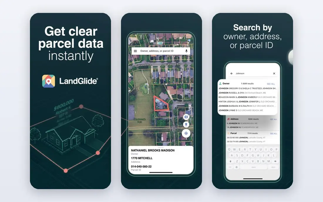
LandGlide is the most single-purpose tool in this list: it exists to show property lines and parcel data. Tap a parcel to see its outline, search by owner, address or parcel number, and view details drawn from county records. The app works on phones and on desktop, which suits agents and buyers who research at a desk and then walk a lot in the field.
Pricing is $9.99 per month or $99.99 per year after a 7-day free trial. The honest catch applies to every app here: boundaries come from public records and phone GPS, so they are estimates, often within several feet, not a legal survey. For research, prospecting and first visits, LandGlide is our pick.
- Parcel boundaries plus owner, address and parcel number search
- Works on desktop and mobile
- Nationwide parcel coverage
- $9.99 per month or $99.99 per year after the 7-day trial
- Boundaries are estimates, not survey-grade
- Data quality varies by county
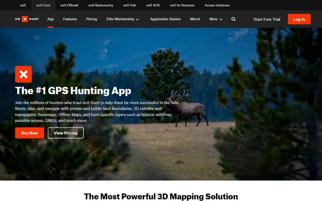
onX Hunt is best known as a hunting map, but its private land layer is why many landowners and buyers use it too. It shows property boundaries, landowner names and public land access, layered over topo and satellite maps, with GPS tracking and offline downloads for areas without signal. That field strength is unmatched in this list.
Premium starts at $29.99 per year for one state, with Premium Two-State at $44.99 and Elite at $99.99, after a 7-day trial, and a limited free Basic tier covers GPS tracking. If you spend time outdoors and want boundaries in the same app as your trail maps, onX Hunt is the best all-round choice.
- Private and public land boundaries plus owner names
- Excellent topo and satellite maps
- Offline maps for the field
- Property data sits inside a hunting app, so the interface is outdoors-first
- Premium is one state, with two-state and Elite tiers higher
- Boundaries vary by county source
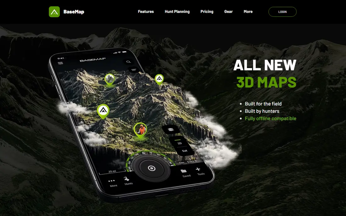
BaseMap doubles as a hunting app and a property line app, much like onX Hunt. Its maps layer parcel boundaries over satellite and topo views, with landowner information where county data supports it, and offline downloads for remote ground. Hunters who also scout land purchases get two jobs from one subscription.
The trade-off is focus. BaseMap is built for outdoor use first, so it lacks the deep owner research workflow of LandGlide or PropertyRadar. Pricing is subscription-based and varies, so confirm the current rate on the BaseMap site. For outdoor users who want parcel lines without a second app, it is a solid alternative to onX.
- Parcel boundaries layered on hunting and topo maps
- Offline maps
- Landowner details in many areas
- Outdoors-first design, not a real estate research tool
- Pricing and tiers change often, so check the site
- Coverage depth varies by state
Acres focuses on land rather than houses: parcel boundaries, ownership, acreage and land characteristics in one map. That makes it useful for buyers comparing rural tracts, farmers checking neighbouring parcels, and agents who specialise in land. The mobile app pairs with a web map for deeper research.
Pricing is subscription-based with a trial, and the current rate is best confirmed on the Acres site. It is not a trail navigation app, so outdoor users should pair it with a mapping tool. For land-first research, Acres earns its place.
- Parcel maps with land, soil and ownership context
- Built for land buyers and rural property
- Web and mobile access
- Subscription pricing is not always published clearly
- Rural data depth varies
- Less of an outdoor navigation tool than onX
Parceled is a straightforward parcel app for real estate use: search a property, see its boundary outline, and check the details that matter before a viewing. Its simplicity is the appeal, since there is no hunting or navigation layer to learn. Agents doing quick parcel checks and buyers comparing lots will find it fast.
The downside is transparency. Pricing and full coverage details are best confirmed on the Parceled site, and data quality follows the county source, as with every app here. For quick, parcel-first lookups, Parceled is a useful lightweight option.
- Parcel search by address or owner
- Boundary overlays for buyers and agents
- Simple interface for quick lookups
- Smaller company with less public pricing detail
- Coverage depends on county data feeds
- Fewer outdoor features than hunting apps
MapPad answers a different question from the rest of this list: how long is that line, and how big is that area. Walk a property edge with your phone and it records the path, distance and acreage, which helps with fencing quotes, mowing estimates and rough boundary walks. A free version covers basic use.
It is not a parcel database, so it will not tell you who owns the lot next door or show official parcel shapes. GPS drift also limits precision, especially under trees. Pair MapPad with a parcel app for records, and use it for the measuring job it does well.
- Walk a boundary and record distance and area
- Simple measuring tools
- Useful for fences, mowing and rough checks
- Measuring tool, not a parcel database
- Accuracy depends on phone GPS
- Fewer owner and record details than LandGlide
Land id, formerly MapRight, serves land professionals, agents and buyers who map parcels daily. It combines parcel boundaries, owner details and acreage with drawing and measurement tools, and it works on the web as well as on mobile. That professional depth suits users who go beyond a single lookup.
Casual users may find it more tool than they need, and pricing is plan-based, so check the Land id site for current rates. For anyone who maps land as part of their work, it is a serious, purpose-built option.
- Parcel data with mapping tools built for land professionals
- Web and mobile access
- Ownership and acreage details
- Pricing sits behind a quote or plan page
- Professional focus may overwhelm casual users
- County coverage varies
PropertyRadar is a research platform first and a map second. Its parcel view sits on top of detailed public record data: owner names, equity, transaction history and property characteristics, with list-building tools for investors and agents. A buyer researching a neighbourhood or an investor building a mailing list gets far more than a boundary line.
That depth comes at a professional price and with a learning curve, so casual users should stick with LandGlide. But for property research as a job, PropertyRadar is the deepest tool in this list.
- Deep owner, equity and property data behind parcel maps
- List building for investors and agents
- Public record depth
- Priced for professionals, not casual lookups
- Learning curve for its filters and lists
- Coverage is US-focused
Regrid offers parcel data for the whole United States, with a free tier that lets you browse boundaries and basic parcel details before paying. The web map is the strongest part, with a mobile app for field checks, and paid plans add exports, filters and larger datasets.
Free users will hit limits on advanced data, and county refresh schedules affect freshness. For a buyer or researcher who wants to explore parcel data without a subscription first, Regrid is the best free starting point in this list.
- Nationwide parcel data with a free tier
- Clean web map plus mobile app
- Parcel details and boundary shapes
- Advanced features and exports sit behind paid plans
- Mobile app is simpler than the web platform
- Data freshness varies by county
How we picked these
We compared parcel coverage, owner data, pricing and mobile access for apps that show property boundaries from public records. We included parcel-first tools, outdoor maps with parcel layers, and measuring aids, since readers arrive with different jobs. Prices were checked against vendor pages and recent listings, and where a vendor does not publish a simple rate we say so. We excluded generic map apps that do not show parcel boundaries.
How accurate are property line apps
Good enough for research, not for legal lines
App boundaries come from county assessor parcel shapes and phone GPS, which is typically accurate within several feet and sometimes worse under trees or near tall buildings. That is fine for finding a lot, planning a walk or checking a neighbour's fence line roughly.
When you need a survey
For building, fencing on a disputed edge, or any legal question, hire a licensed surveyor. Only a survey establishes a legal boundary, and app makers say so themselves. Treat every app line as an estimate until a surveyor confirms it.
Tips for better results
Check the same parcel in two apps, since county feeds differ. Stand in the open for a better GPS fix, download offline maps before visiting rural land, and confirm owner details against the county assessor site for anything that matters.
Sources
Frequently asked questions
What is the best free property line app?
Regrid offers a free tier for browsing parcel data, and onX Hunt has a limited free Basic tier for GPS tracking. LandGlide and onX Hunt both offer 7-day trials of their full parcel features, which is the best way to test coverage in your county.
How accurate are property line apps?
Most private land boundaries in these apps are accurate within about 5 to 10 feet, depending on the county data source and your phone's GPS. That is enough for research and scouting, but not for legal or construction decisions.
Do property line apps show who owns a property?
Yes, most parcel apps show owner names drawn from public county records, along with parcel numbers and acreage. LandGlide, PropertyRadar and Regrid are strongest on owner details.
Can I use a property line app instead of a survey?
No. An app shows an estimate from public records, while a licensed surveyor measures and certifies the legal boundary. Use apps for research, and hire a surveyor before building or settling a dispute.
Which app is best for hunting land boundaries?
onX Hunt is the standard choice, with private and public land layers, owner names and offline maps. BaseMap is the closest alternative, with a similar mix of hunting maps and parcel overlays.