Best Road Trip Apps in 2026: 9 Apps Compared
By ToolNimba Editorial Team October 28, 2026 10 min read

- Top pick
 Roadtrippers
Multi-stop trip discovery
Starting priceFreeCheck out RoadtrippersRead our review - Runner-up
 Wanderlog
Group trip planning
Starting priceFreeCheck out WanderlogRead our review - Also great
 Google Maps
Everyday navigation
Starting priceFreeCheck out Google MapsRead our review
How we researched this
We compared official pricing and feature pages, app store listings, privacy policies and public user reviews. Prices change, so check the provider's site before you pay.
Key takeaways
- No single app does everything well, so most trips need a small stack: one planner, one navigator, and one fuel or stops app.
- Roadtrippers and Wanderlog lead for multi-stop planning, while Google Maps and Waze lead for live driving.
- GasBuddy and iExit save the most money and time on long highway trips, especially when fuel prices are high.
- Download offline maps and content before remote stretches, since signal can disappear in parks and rural areas.
Quick comparison
| Name | Best for | Starting price | Free plan | |
|---|---|---|---|---|
| Roadtrippers | Multi-stop trip discovery | Free | Yes | Visit |
| Wanderlog | Group trip planning | Free | Yes | Visit |
| Google Maps | Everyday navigation | Free | Yes | Visit |
 Waze | Live traffic and hazard alerts | Free | Yes | Visit |
 GasBuddy | Finding cheaper fuel | Free | Yes | Visit |
 iExit | Interstate exit services | Free | Yes | Visit |
 Campendium | Campground research | Free | Yes | Visit |
 iOverlander | Free camping and overlanding | Free | Yes | Visit |
 AllTrails | Hiking stops along the route | Free | Yes | Visit |
The best road trip apps
We compared official feature pages, app store listings, pricing, offline support, and public reviews for apps live in 2026. The list covers planning, navigation, fuel, stops, camping, and outdoor activities, so you can build a stack that fits a weekend drive or a multi-week trip.
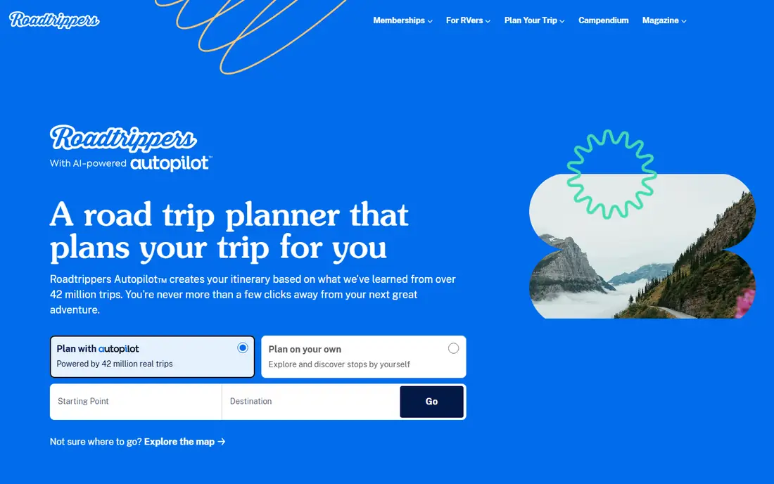
Roadtrippers is the planner most road trippers should start with. You enter a start and end point, then add attractions, restaurants, parks, and quirky stops along the route. The app suggests places you would miss with a simple point-to-point navigator, which is the whole point of a road trip.
The free tier limits how many stops you can add, while paid plans raise that limit and add offline maps and collaboration. Check current plan prices on the vendor site, since tiers have changed over time. Use Roadtrippers for planning, then export or follow the route in Google Maps for driving, since dedicated navigation apps handle live traffic better.
- Large database of roadside attractions and stops
- Multi-stop route building
- Gas cost estimates for planned routes
- Free version limits stops
- Best coverage is in the United States and Canada
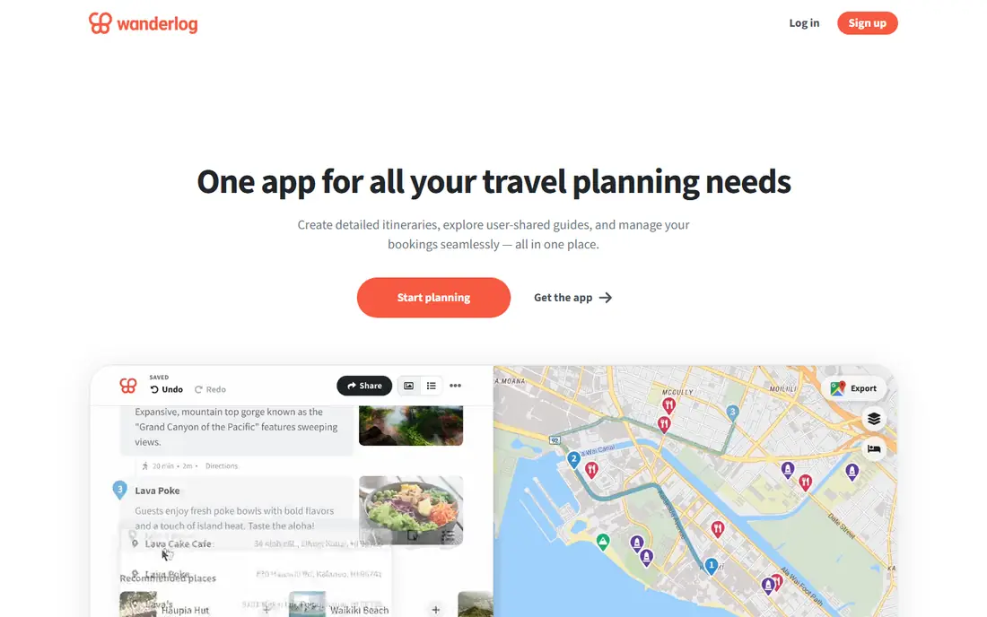
Wanderlog suits trips planned with friends or family. Multiple people can edit the same itinerary at the same time, add places, and track shared costs without passing spreadsheets back and forth. The split view of map and daily plan makes it easy to see where each stop falls and how long each drive takes.
The free tier covers most planning needs, while Pro adds offline access and reservation imports. Wanderlog is less focused on quirky roadside attractions than Roadtrippers, so it works best as a group organizer rather than a discovery engine. Pair it with Roadtrippers if you want both group planning and hidden-gem stops.
- Real-time group editing
- Map and itinerary views side by side
- Built-in expense tracking and splitting
- Offline access requires a paid plan
- Less roadside discovery than Roadtrippers
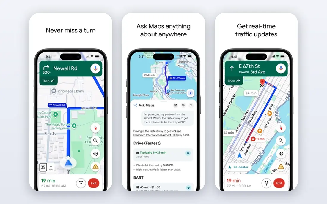
Google Maps is the navigator most drivers already know, and that familiarity is an advantage. It handles traffic, rerouting, and arrival times well, and offline downloads cover areas with poor signal. Place pages include hours, photos, and reviews, which help you decide whether a stop is worth the detour.
For complex trips, Google Maps is less useful as a planner. It supports multiple stops, but it does not build day-by-day itineraries or track trip costs. Use it for driving after you plan in Roadtrippers or Wanderlog, and download your route region before you leave.
- Reliable turn-by-turn navigation
- Offline map downloads
- Huge place database with hours and reviews
- Limited multi-stop planning compared with Roadtrippers
- No built-in trip itinerary view
Waze is the best second navigator for busy highways and city driving. Community reports warn you about crashes, stopped cars, speed traps, and closures before you reach them, and rerouting is fast. Many drivers run Waze alongside Google Maps, using one for routing and the other for alerts.
The app needs a data connection, so it is not a backup for remote areas. It also lacks the planning and place depth of Google Maps. Keep Waze for live conditions, and keep an offline map ready for stretches where signal drops.
- Real-time alerts for traffic, police, hazards, and road closures
- Community-reported fuel prices in many areas
- Simple, driver-focused interface
- No offline navigation
- Fewer planning features than Google Maps
GasBuddy pays for itself on long trips, especially when fuel prices are high. You can search along a route, compare nearby stations, and filter by diesel, premium, or amenities such as food and restrooms. The app also estimates trip fuel cost, which helps with budgeting before you leave.
Prices are crowd-reported, so a station price may have changed since the last update. Check the time stamp on a price before driving far out of your way for a small saving. For most drivers, the free tier is enough, and the paid tier is optional.
- User-reported fuel prices along your route
- Station filters by fuel type and amenities
- Trip cost estimates
- Prices depend on user reports and can be out of date
- Paid tier adds features most casual users do not need
iExit answers a simple question that matters on long highway drives: what is at the next exit, and is it worth stopping? The app lists services by exit, so you can plan fuel, food, and rest stops without guessing. That clarity helps families and drivers who want to avoid backtracking to a missed exit.
The limit is geography. iExit covers US interstates, so it will not help on rural roads, in cities, or abroad. It also works best as a companion to a navigator, not a replacement for one. For interstate road trips in the US, it is a small app with an outsized payoff.
- Lists gas, food, lodging, and rest areas at upcoming interstate exits
- Works well for highway planning
- Simple list view while driving
- United States interstates only
- Limited value off highways or outside the US
Campendium is the research tool to use before booking a campground on a road trip. Reviews cover site quality, noise, hookups, and cell signal, which matters if you need to work from the road. Filters help you find sites for your rig size and budget, and photos show what a site actually looks like.
The free tier covers most research, while Pro adds offline access and extra filters. Campendium does not book sites for you, so you still need to reserve through the campground or park system. For RV and tent campers, it is more useful than a general hotel app.
- Campground reviews with cell signal reports
- Filters for hookups, price, and rig size
- Photos and site details from campers
- Some detailed features require Pro
- Coverage is strongest in the United States
iOverlander suits travelers who camp for free or travel off the main tourist routes. The community database lists dispersed campsites, water points, mechanics, and border information, with notes on access and recent conditions. That detail is hard to find in mainstream travel apps, especially outside the United States.
Because entries are community-reported, you should verify access, rules, and safety before driving to a remote spot. Read recent reports, check local regulations, and have a backup plan. For overlanders and budget campers, iOverlander is an essential free tool despite its plain design.
- Database of free campsites, wild camping spots, and services
- Community updates on access and safety
- Works well for overland travel
- Information is community-reported and varies in quality
- Interface is functional rather than polished
AllTrails turns a driving trip into an outdoor trip by helping you find hikes near your route. You can filter by length, elevation, difficulty, and features such as waterfalls or dog-friendly trails, then read recent reviews for conditions. That makes it easy to add a morning hike without a separate research session.
The free tier covers searching and basic maps, while Plus adds offline maps, wrong-turn alerts, and extra layers. Download maps before heading into parks with poor signal, and check recent reviews for closures or hazards. AllTrails is the best add-on app for road trippers who want trail time between drives.
- Large trail database with reviews and photos
- Filters for length, difficulty, and features
- Offline maps with Plus
- Offline maps and extra features require Plus
- Trail conditions depend on recent user reports
How we picked these
We reviewed official feature pages, app store listings, pricing, offline support, and public reviews for apps live in 2026. We kept apps that solve a clear road trip job, from planning and navigation to fuel, camping, and hiking, and we left out general travel apps that do not help on the road. Where paid tiers vary, we list the free starting price and direct you to the vendor site for current plan details.
How to build the best road trip app stack
Pick three core apps first
Start with Roadtrippers or Wanderlog for planning, Google Maps for navigation, and GasBuddy for fuel. Add Waze for live alerts on busy routes, and iExit for US interstate trips. That core stack covers most drives without cluttering your phone.
Prepare for offline stretches
Download Google Maps regions for your full route, save AllTrails maps for hikes, and cache any Roadtrippers or Wanderlog content that supports offline use. Charge phones with a car charger, and keep a paper backup of key addresses for remote parks. Offline prep matters more than any single paid feature.
Plan stops, not just destinations
Add fuel, food, rest, and overnight stops before you leave, especially in rural areas where services are far apart. Check hours and seasonal closures, since a stop that looks good on a map may be closed on arrival. Build in buffer time for traffic, weather, and unplanned detours, and never use a phone in your hand while driving.
Sources
- https://roadtrippers.com
- https://wanderlog.com
- https://maps.google.com
- https://www.waze.com
- https://www.gasbuddy.com
- https://iexitapp.com
- https://campendium.com
- https://ioverlander.com
- https://www.alltrails.com
- https://travelwice.com/road-trip-planning-apps-2026/
- https://autio.com/here-and-there/best-road-trip-apps-2026